USA-193 was in an elliptical orbit with an apogee of 2,700km for instance.

No, it wasn't. As I pointed out, UAS-193 was in a nearly circular and low orbit around 350 km from the outset. The 2700 km apogee figure for Burnt Frost is the max alt that some debris was lofted to after the impact.
 

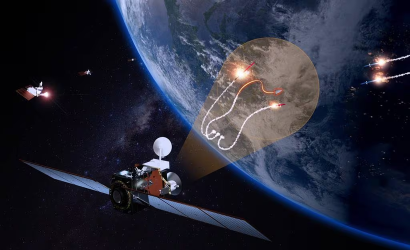
Space Force officials have characterized their responsibilities for the GMTI satellites — and, eventually, other moving target indicator satellites (MTI) designed to track airborne targets — as simply an extension to the heavens of the Air Force’s US Code Title 10 role in JSTARS. Title 10 governs military roles and missions, whereas Title 50 governs those of intelligence agencies. That said, there long has been a gray zone between the two.

“JSTARS was the air model, providing situational awareness to the combatant commanders from the air. What we’re doing is taking that air vision and elevating it into space, so it is no different,” Gen. Michael Guetlein, Space Force vice chief, told the annual McAleese Defense Conference on March 7. “From a Title 10 perspective, we have the exact same responsibilities to provide situational awareness to the battle commander on tactically relevant timelines.”
 
No, it wasn't. As I pointed out, UAS-193 was in a nearly circular and low orbit around 350 km from the outset. The 2700 km apogee figure for Burnt Frost is the max alt that some debris was lofted to after the impact.
It doesn't make sense to quote the altitude the debris reached, but yeah, I see that's what the stupid report is doing alright. I interpreted that as an elliptical orbit. Nevertheless, the point still holds. Some recon satellites are on elliptical orbits and even dip below 100km*, most on geocentric orbits would orbit very low like USA-193.

*https://pubs.aip.org/physicstoday/a...re-does-outer-space-begin-As-suborbital-space

SM-3 IIA however has the potential to reach almost any LEO orbit and 24 of them have been produced every year since introduction.
 
I cannot think of a single satellite that I remember having a perigee below 300km. Can you provide an example?
 
I cannot think of a single satellite that I remember having a perigee below 300km. Can you provide an example?
Well, we're going off on a strawman here really, because 250km is not the maximum intercept altitude of any variant of SM-3, IA, IB or IIA, nor was it the intended altitude of USA-193, which was circa 350km, still well inside any SM-3 variant's intercept ceiling. But anyway:


Last edited:


Last edited:


Last edited:
Fair disclosure: working on an article I will submit to publications, so if you do not want to give up sources and means, no need to respond.

The questions are broadly concerning satellite EW possibilities.

Are modern UHF satellites AESA based at this point? For instance, what does something like Starlink use? As such, presumably they have some frequency agility? If so, could a communications satellite in LEO potentially be used to jam a particular receiver on the surface? Alternatively, could a purpose built satellite achieve this if a communications satellite could not? Would a satellite with a passive array facing away from earth and an active array facing down be able to detect a downlink and project a jamming signal on a reciprocal bearing in realtime like an aircraft’s RF digital memory jammer?

L band question; do satellite navigation signals have any overlap or near overlap with Link 16 bandwidth?
 
Last edited:


Last edited:

The DRIFT program utilizes multiple Umbra Synthetic Aperture Radar (SAR) satellites, which operate in formation to enable the creation of advanced processing algorithms. These developments in coordinated flying and data collection reflect Umbra's expertise in remote sensing and its dedication to advancing technological boundaries in space systems.
The next phase involves an extensive collection campaign over several months, where Umbra's SAR satellites will collect bistatic and multistatic data sets for further evaluation by DARPA and associated contractors. The phase is set to culminate with an in-space demonstration of the multistatic capabilities developed by Umbra.
Jason Mallare, Vice President of Global Solutions at Umbra, shared his enthusiasm, saying, "We're grateful to contribute to DARPA's vision, leveraging top-tier U.S. capabilities for asymmetric advantage. Umbra's differentiated technology and relentless focus on tech evolution drive us forward. We're excited about the future this technology and similar capabilities hold for Umbra and the nation."
Recently, Umbra showcased bistatic imagery obtained from its tandem satellites. With six satellites currently deployed and plans for a total of 32 in strategic pairs, Umbra's SAR satellites provide indispensable day/night, all-weather monitoring capabilities. These satellites offer high-quality SAR data crucial for the U.S. Government, its allies, and commercial entities, providing them with actionable insights regardless of weather conditions.


Last edited:


Last edited:


Space Systems Command, in partnership with SpaceWERX — Air Force Research Lab’s space innovation arm — awarded Washington-based Starfish Space $37.5 million for the effort. The company builds and operates a line of satellites, dubbed Otter, that can service other spacecraft. Depending on a customer’s needs, Otter can dispose of defunct satellites or provide additional propulsion or thrust to enhance its mission.
Under the SSC contract, Starfish will dock one of its Otter vehicles with Space Force satellites to perform a range of functions — from extending their service life to moving them to a new orbit. The service hasn’t identified which satellites Otter will support.
“The Otter spacecraft will be capable of performing autonomous rendezvous, proximity operations, and docking (RPOD), compatible with a wide range of clients, including those that were never designed or configured for docking,” SSC said in a May 20 statement. “This capability gives the U.S. Space Force a range of options to support existing assets and allow future assets to be supported without imposing additional configuration requirements.”

1716303559529.png


Last edited:


Similar threads

Please donate to support the forum.

Back
Top Bottom