- Joined
- 21 April 2009
- Messages
- 13,551
- Reaction score
- 7,153
From the Air Force Association:
The Fix Is In: The Space Radar, contracts for which were canceled in 2008, and which has been a very quiet topic since then, is apparently a healthy though highly classified program, and may even have some operational components. Bruce Carlson, National Reconnaissance Office director, told the Daily Report in an interview that "we think we have solved that problem. And I think we've convinced most people in the [intelligence] community that we've solved that problem." All Carlson could say about its status is that there is "a solution." When asked if it's "an overhead," meaning a satellite, he replied: "It's a system we can operate, yes." Carlson did acknowledge that "it cost a lot of money. It wasn't on time, but now we're there. We've got the technical solution, we've got the produceability." He added that a solution is in hand "for the next few years. Now, you can't rely on just one solution forever, but we think we've got that problem behind us."
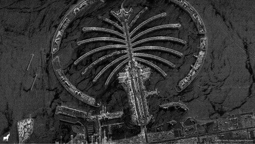
The program envisions something like this:
Space Radar Facts: With zero fanfare, the Air Force recently revised its fact sheet on the Space Radar, which became defunct in 2008, at least to the public eye. The revised fact sheet states that the program is envisioned as a constellation of nine satellites "providing worldwide coverage" and yielding five kinds of surveillance products: synthetic aperture radar imagery; surface moving target indication—both ground and ocean target movement detection and identification; open-ocean surveillance to detect ships; high-resolution terrain information, yielding 3-D topographic maps; and "advanced products" in the realm of geospatial intelligence. The Space Radar will "profoundly change the nature of global persistent ISR" and provide enhanced global deterrence "through the mere threat of observation," states the document.


